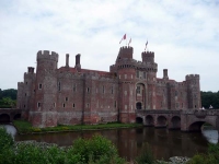
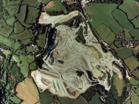
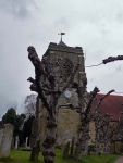
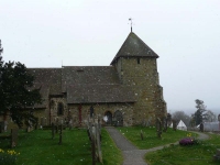
Was in the neighbourhood and visited Herstmonceux Castle and the Observatory Science Centre (the site of the former Royal Observatory at Herstmonceux).
Tag Archives: Photos
Waymerks – ULTREIA (spoilers)
Back in 2002 the Waymerks Project by local artists created 13 kists for 13 waymerks – one for each section of the Southern Upland Way.
It ran for a number of years, though the project has now finished (and no new merks are going to be minted) some kists remain, and a couple had merks when I completed the walk.
I found most of the kists, though some were only remains…
The Pennine Way – done!
Well I took a leisurely 19 days to complete the 260 miles of the Pennine Way, and after a week back home I have finally posted a daily journal of my travels from Edale to Kirk Yetholm, create a gallery of 147 photos, and found a few photos to create some new header images for this blog.
Tregothnan, what a corker!
The weather was not good, and the forecast was not much better, but I had to do something today having had a very good breakfast (continuing to work my way through the 40 different sausage selections to choose from at the B&B!). Andy and Jane recommended that I visit Tregothnan, the traditional home of the Boscawen family, and the seat of Lord Falmouth, which is only open for one weekend of the year and this weekend is it – looks like my luck was in, lets hope it holds.
Eden Project revisited
I had such a good time visiting last month, I was really pleased to be back again now. I had only ever spent time down ‘in the pit’ but I was curious about the wider estate. Having a look at Google Maps and Microsoft Live Search Map gave a real insight into the evolution of the site.
A week in the Brecon Beacons
David invited me to visit Dyffryn Crawnon in the Brecon Beacons for a week, and while he set about on repairs to the bunkhouse I have the opportunity to stretch my legs over a beacon or two.
The first amble was up and around the head of Dyffryn Crawnon valley, but from there I caught glimpses of Pen-y-Fan to the north and a few interesting looking mountains closer to home.
Gover Hill to Gravesend
Starting the final leg of the Wealdway at Gover Hill I had just 16 miles or so to get to Gravesend. The first few miles of walking was through a lovely woodland of chestnut coppice and oak standards. It had been the first be of decent production woodland I had walked through on my entire journey. It was not long however until I reached the other side and the view over to the North Downs.
Stone Cross to Gover Hill
Today (day 3) started off with quite a bit of road walking so I was able to make good progress on the tarmac of the narrow country lanes. Before long I was high up on Bidborough ridge and the snow started up again – though this time they were large delicate flakes which drifted haphazardly in the breeze.
East Hoathly to Stone Cross
Thankfully the strong northerly winds had blown itself out overnight, though the forecast still mentioned wintery showers, as I started out on day 2 from East Hoathly. The frost on the ground had stiffened up the mud just a little, though most of the fields were permanent pasture and not too muddy or slippery underfoot.
I was soon walking through Great Wood, its name the reminder of what was once here. It had probably been decimated several times over the centuries – nearby there are extensive remains of former iron-foundries which would have used the wood as fuel, but more recently the Great Storm of 1987 destroyed much woodland in the area.
Beachy Head to East Hoathly
The Wealdway guidebook had been looking lost on my bookshelf for quite a while and, as a very kind lady at Kent County Council had copied it for me as it had gone out of print, I felt it had laid there for long enough. At 80 miles long it would split nicely into 4 parts – as the perfect accompaniment to the Easter bank holidays.
