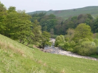
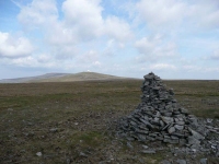
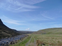
Well I took a leisurely 19 days to complete the 260 miles of the Pennine Way, and after a week back home I have finally posted a daily journal of my travels from Edale to Kirk Yetholm, create a gallery of 147 photos, and found a few photos to create some new header images for this blog.
Category Archives: Pennine Way
Day 19 – Byrness to Kirk Yetholm
The forecast was not great, and it looked like it might be worse tomorrow – while I had the option of doing the last stage of the Pennine Way in 2 days I thought I would try and do it in one – all 26 miles!
After an early breakfast I was out on the road by 8am, so that I would have as much time as possible to complete the stage. I hoped it would take around 10 hours, though it could easily take more.
There was a sharp climb out of the valley, along a narrow path through tall plantation conifers – then at the top of Byrness Hill I was hit full in the face by the gale force wind that was still blowing from the northeast. That wind was going to make the day a whole lot harder.
Day 18 – Bellingham to Byrness
After a bit of road walking, and then continuing along a farm track, it was again up onto heather moorland.
I was so pleased that the ground was so dry as there were no slabs to aid you on your way, and by the look of the deep footprints left in the peat this area could be quite a quagmire when it is wet.
Day 17 – Once Brewed to Bellingham
The wind had blown the clouds away overnight, and was still attempting to blow away anything that was not fastened down. Thankfully I had my energy back again, which was a good thing, as I would need all my strength to make headway into the wind.
Day 16 – Greenhead to Once Brewed
Today was a very short walking day – the shortest of the whole trip – no matter how slow I was. I was feeling better, but still lacked some energy, particularly on the up hill bits.
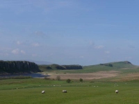
Leaving late I was quickly back onto the Pennine Way, and walking alongside a huge ditch – which was part of the Hadrian’s Wall defences. It was like all the climbs of the day, short and sharp – and with a seemingly gale force wind that would hit you in the face every time you reached the top.
Day 15 – Slaggyford to Greenhead
While the Pennine Way seemingly wandered around the farmland to the north of Slaggyford with seemingly little purpose, I decided to stick to the easy walking of the dismantled railway for a mile or so to near Knarsdale, before rejoining the route which is also shared with the Maiden Way and the course of an old Roman road.
After a brief excursion back up onto moorland the path descends again into farmland, before rising once more onto a more significant piece of moorland across Featherstone and Blenkinsopp Commons.
Day 14 – Garrigill to Slaggyford
Having not felt too well for the last few days it was good to have a short easy stage up to Slaggyford – rather than stretching out to get to Greenhead in one go.
The Pennine Way wanders around the River South Tyne valley, at times keeping very close to the river’s edge, at others meandering a few hundred yards away, so there will be little moorland to be seen today.
Day 13 – Dufton to Garrigill
I could see the day’s main objective from the breakfast table, and while the sun was out the clouds were ripping across the tops of the fells at quite some speed.
Thankfully there was no scrambling involved (as I was not feeling too well), the path climbed steadily up towards the summit of Green Fell, and then after short descents and ascents went over the peaks of Great Dun, Little Dun and Cross Fells.
High Cup Panorama
High Cup is a perfectly formed U-shaped valley that has been carved out of the side of Dufton Fell.
Day 12 – Langdon Beck to Dufton
Today I would spend most of my time walking west, ending up further from Kirk Yetholm at the end of the day than I was at the beginning – it was however an excellent day. It was cold outside, though by the time I was walking thankfully most of the frost had gone. The sun was out and the sky was a deep blue, made darker by a few brilliant white clouds.
It was a short walk back to the River Tees, though I cut the corner to Widdy Bank Farm, from where the path stuck closely to the river again – at times almost getting squeezed out between steep bolder-strewn slopes and the fast flowing river. I was really pleased the water level was low as it would have been much harder clambering over the boulders higher up the slope.


