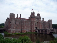
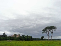
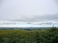
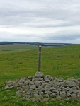
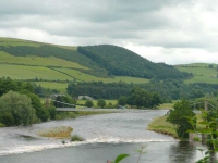
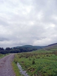
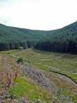
Was in the neighbourhood and visited Herstmonceux Castle and the Observatory Science Centre (the site of the former Royal Observatory at Herstmonceux).
Monthly Archives: July 2008
Walked the Southern Upland Way
If you are wanting remoteness and to get away from it all – in a long distance walk – then the Southern Upland Way fits the bill perfectly. On most days I did not see another person out walking, though by reading some of the visitors books in the bothies there is a regular trickle of people using the route.
Tunnock’s Caramel Wafer
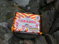
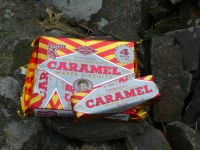
Tunnock’s Caramel Wafer is a bar of pure deliciousness, consisting of 5 layers of wafer as a way of separating 4 good layers of caramel – and completely covered in chocolate. It is then wrapped in a classy foil-paper wrapper, instead of the terrible plastic coatings that are nowadays often used.
Waymerks – ULTREIA (spoilers)
Back in 2002 the Waymerks Project by local artists created 13 kists for 13 waymerks – one for each section of the Southern Upland Way.
It ran for a number of years, though the project has now finished (and no new merks are going to be minted) some kists remain, and a couple had merks when I completed the walk.
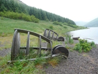
I found most of the kists, though some were only remains…
Day 11 – Longformacus to Cockburnspath
Thankfully after the tribulations of yesterday with transport I was back at Longformacus before 9am and heading quickly east. While it was only 17 miles to Cockburnspath I had to be there before the bus left in order to get to the B&B for the evening in Dunbar.
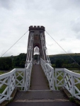
The path twisted and turned its way through farmland, then moorland, on its way to Abbey St Bathans and another suspension bridge over a river. It then continued passing several large farms until it reached the A1 and the East Coast Mainline Railway which both snaked through a deep valley. After crossing both it was then a long slow walk up hill through the final stretch of plantation forest before I caught my first glimpse of the North Sea.
Continue reading
Day 10 – Lauder to Longformacus
The route was very twisting and turning on leaving Lauder, the straight Roman Roads of yesterday seem to have vanished. The views back towards Thirlstone Castle were also a bit disappointing due to the trees that surrounded it, so I turned to the east and headed uphill amongst the pasture and small patches of woodland.
To the south the sky looked blue with a few ranks of fluffy white clouds stretching out into the distance. Unfortunately overhead and to the east the sky was slate grey and occasional heavy drops of rain were getting more frequent.
Day 9 – Galashiels to Lauder
The sky looked heavy with big lumps of dark black clouds, though with a few lighter patches and a positive forecast gave a bit of hope for a dry day – so I took my time over breakfast.
As I left the B&B in Melrose I had a brief thought of rejoining the Southern Upland Way here, but as the sky was brightening fast I caught the bus back to Galashiels. After a few twists and turns through the streets of the town I was back on track and heading around the town and back to Melrose.
Day 8 – St Mary’s Loch to Galashiels
I half opened my eyes, and focused concentration on my hearing – no rain, excellent! The forecast suggested once it started it would be set in for the day, hopefully it has not made its way this far north… As I stepped out of the Inn it started to rain – soft, wet rain, the sort that really soaks in.
The first bit of walking was really easy along the edge of the loch, and half way along and I was soon passing an interesting sculpture – Shinglehook.
Day 7 – Moffat to St Mary’s Loch
I decided not to use the main road to get back on the Southern Upland Way, and took the alternate route out of town using minor roads. It was then a long slow walk up hill into the forest. At the gate a notice warned if forestry operations were being undertaken to use the high level route – thankfully they did not.
The clouds that looked threatening overhead had thankfully continued on their way, as I had headed in the other direction, it was good to see the sky was brightening up. While I continued along the lower route it did not mean that it did not head up hill, and it had taken some time to reach the far edge of the forest.
Day 6 – Wanlockhead to Moffat
I was glad I was starting from Britain’s highest village, but there were still some long climbs today that would take me over the highest point on the walk on a day that was almost 25 miles long. Thankfully it was cool and cloudy as I started out from Wanlockhead, really good walking weather, though it was not to last with some early rain and then heavier showers in the afternoon.
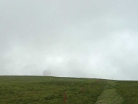
The first objective was to make it to the ‘Golf Ball’ radar station at the top of Lowther Hill (the highest point on the walk at 725 metres), but as I made my way over the first ridge it was nowhere to be seen, shrouded in low cloud which was clinging to the tops of the hills on the route ahead.
