Having not felt too well for the last few days it was good to have a short easy stage up to Slaggyford – rather than stretching out to get to Greenhead in one go.
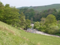
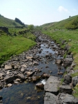
The Pennine Way wanders around the River South Tyne valley, at times keeping very close to the river’s edge, at others meandering a few hundred yards away, so there will be little moorland to be seen today.
Making a late start from the B&B, and taking my time, I arrived in Alston just in time for a mid morning cup of tea. Having drunk the place dry of tea I headed out again and found a nice spot in the sun near Gilderdale Burn out of the wind to watch the view go by.
There was not much to be seen at Whitley Castle (just a few Roman Fort earthworks) so I continued to amble towards Slaggyford. At times the path comes close to the dismantled railway that runs along the valley, though I suppose at the time the Pennine Way was first planned it would have still been in use.
Eventually I did make use of the dismantled railway as coming into Slaggyford it was the easiest way to get to the B&B, which was adjacent to the old station.
View the map in Google Maps, or here is the Google Earth KML file.More photos (from all the days of walking) can be found in the photo gallery.


Which day did you take the photo of Slaggyford Station? Myself & another colleague were working on the station from 19th – 23rd may hence the mowed platform area + the white line. We are volunteers from the South Tynedale Railway. We are looking after the station ready for when the South Tynedale Railway returns in a few years time from Kirkhaugh – it’s current terminus.
Is it possible I could have a copy of your photo to put in the Tynedalesman – the journal of the STR with your permission?
Thanks,
Mark.
@Mark
It was 22 May 08 3:46 pm when I took the photo of the station (or so my camera says). I was wondering why it was so well kept, and now I know why.
I have sent you the image by email which you are welcome to use in your journal.