I got some wonderful walking books, guides and maps for Christmas (though for this walk I already had An Ashdown Forest Perambulation by Per-Rambulations, it had sat on the shelf for a good six months) and so spent the last few days making plans…
It soon became apparent that if I was going to make full use of my time and money I was going to have to start carrying a bigger pack, not just a day pack. A walk over Asdown Forest, being close to home would be perfect – just in case anything went badly wrong like it had with the cycling. The Perambulation was written in 4 stages, though I hoped that I could do it in a couple of days, 3 max. It would be a real test with a full pack and the target milage was 20 miles!
The terrain was fairly gentle, thought with a couple of steep climbs, but the clay soil underfoot would provide a real challenge as I was soon to find out on day 1.
The route is a figure of 8, so just in case I was able to make the target I started at the crossover point at Gills Lap (Galleons Leap in Winnie the Pooh). The weather was good and it was fairly clear visibility (of the planes landing at Gatwick Airport). It had been raining recently so the ground was a bit tricky underfoot as I headed off.
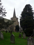
I made it to Rotherfield in good time, despite some tricky technical sections of path which took me through a couple of golf courses. I am not sure what sort of sight I might have been sitting opposite the church eating my lunch, I had one very muddy boot covered in a really sticky light-yellow clay. The track into Rotherfield had been quite good, except for the sort stretch of bridleway that had been churned up and made into a quagmire.
Carrying on I was soon able to find some long grass to walk through and it polished my boots up a treat. The next obstacle was the railway line, which I passed under 3 times as I made my way close by to Eridge. I was on the right track, it could be that the writer of the guide liked trains…
Generally though the ground was not improving and the walk was taking me and and down various small valleys, and I was slowing down. As the light started to fade I decided it would not be that great to continue in the dark the last couple of miles and fortunately found a very good taxi service waiting in Hartfield (this is where the walk will continue from tomorrow) to help me back.
In all I had managed 18 miles and my new pedometer read 35,733 steps. Something was not right and I reviewed the milage (it was spot on 18), now I know I have fairly long legs but I was certain that my stride was not 81cm. Perhaps I had better read the instructions again before setting out!
View the map in Google Maps, or here is the Google Earth KML file.


