Today I would spend most of my time walking west, ending up further from Kirk Yetholm at the end of the day than I was at the beginning – it was however an excellent day. It was cold outside, though by the time I was walking thankfully most of the frost had gone. The sun was out and the sky was a deep blue, made darker by a few brilliant white clouds.
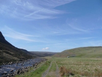
It was a short walk back to the River Tees, though I cut the corner to Widdy Bank Farm, from where the path stuck closely to the river again – at times almost getting squeezed out between steep bolder-strewn slopes and the fast flowing river. I was really pleased the water level was low as it would have been much harder clambering over the boulders higher up the slope.
The way ahead was then blocked by the main flow out of Cow Green Reservoir, and the fabulous Cauldron Snout waterfall with a scramble up the side to get to the bridge at the top.
With the waterfall behind me the moorland stretched out ahead of me, with just a red flag flying in the distance for company. Keeping to the path, and minding not to wander into the danger area, I was soon at the highlight of the day – High Cup.
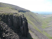
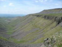
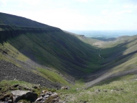
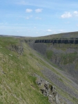
High Cup is a perfectly formed U-shaped valley that has been carved out of the side of Dufton Fell. In effect it is a deep chasm surrounded by grey-blue dolerite crags, whose continued crumbling scatters scree down the flanks of the valley. It is often referred to as High Cup Nick, though that is only one part of the huge scar, and is sometimes applied to the waterfall.
The Pennine Way winds its way along the northern side of High Cup, and then descends down into the village of Dufton.
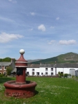
Before heading off to find the B&B, I stopped for an ice cream at the Old Post Office, which provided a good view of tomorrow’s challenge: Knock Fell, Great Dun Fell (with its radar dome), Little Dun Fell, and then finally Cross Fell (the highest point in England outside of the Lake District at 893m). Lets hope the weather is good!
View the map in Google Maps, or here is the Google Earth KML file.More photos (from all the days of walking) can be found in the photo gallery.
