I half opened my eyes, and focused concentration on my hearing – no rain, excellent! The forecast suggested once it started it would be set in for the day, hopefully it has not made its way this far north… As I stepped out of the Inn it started to rain – soft, wet rain, the sort that really soaks in.
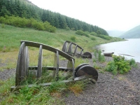
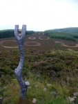
The first bit of walking was really easy along the edge of the loch, and half way along and I was soon passing an interesting sculpture – Shinglehook.
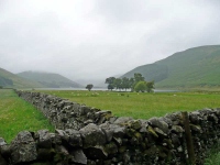
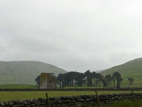
Leaving the loch behind me it was then up and over the hills to Traquair, passing ruined towers of ancient villages. Then after the summit of Blake Muir it was downhill all the way to Traquair village.
I had made good time, but not good enough to make it to the tearoom of Traquair House (the oldest continuously occupied castle in the British Isles, which I suspect means they do good tea and cakes having had all the time to practice), so I sat on a bench in the outskirts of the village in readiness for the second half of the walk…
The signpost helpfully declared 20km to St Mary’s Loch and 21km to Galashiels, but what it failed to mention was the route to St Mary’s Lock is pretty flat, whereas several 500+ metre hills stood between Traquair and Galashiels.
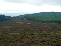
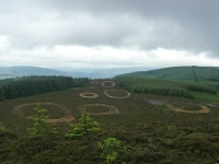
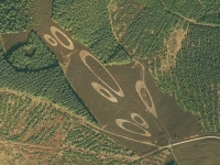
I quick stop off at the bothy above Traquair was more symbolic than anything, as I had stopped at all of the others I had come across, so I was soon on my way again up to the top of Minch Moor and the Resolution Point sculpture (formed of circles of cut heather).
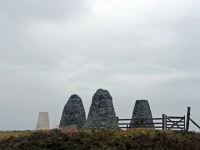
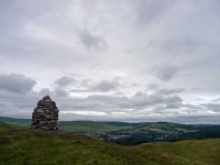
In the distance I could see the Three Brethren cairns, but it would be a while before I would reach them, and it was such a shame to get there to find a fence ran between them.
I then had to negotiate a stretch of plantation forest, and follow the diversions, but at least I was heading gently downhill on good tracks. It was then over the River Tweed where the canoeists were having fun with the increased water levels due to the recent rain – it did look fun, and perhaps a touch drier than walking.
I then realised that the path headed uphill again, and I was still 4 miles from Galashiels. I eventually made it to the top of a hill overlooking the town, and paused for a short while before heading down into the town to find a taxi to take me to Melrose where the B&B was. You would have thought Galashiels would have accommodation, though I was particularly pleased with the high class facilities of Melrose once I got there.
View the map in Google Maps, or here is the Google Earth KML file.More photos (from all the days of walking) can be found in the photo gallery.

LOVED THE SCENERY I;M HOPING TO GO TO SCOTLAND NEXT MAY AT THE MOMENT I LIVE IN AUSTRALIA WHICH IS ALSO A BEAUTIFUL COUNTRY THERE IS SO MUCH I WANT TO SEE SO I,M HAVING TO SAVE VERY HARD TO SEE SOME OF MY OLD LAND CHEERS ISABEL